Natural Resources
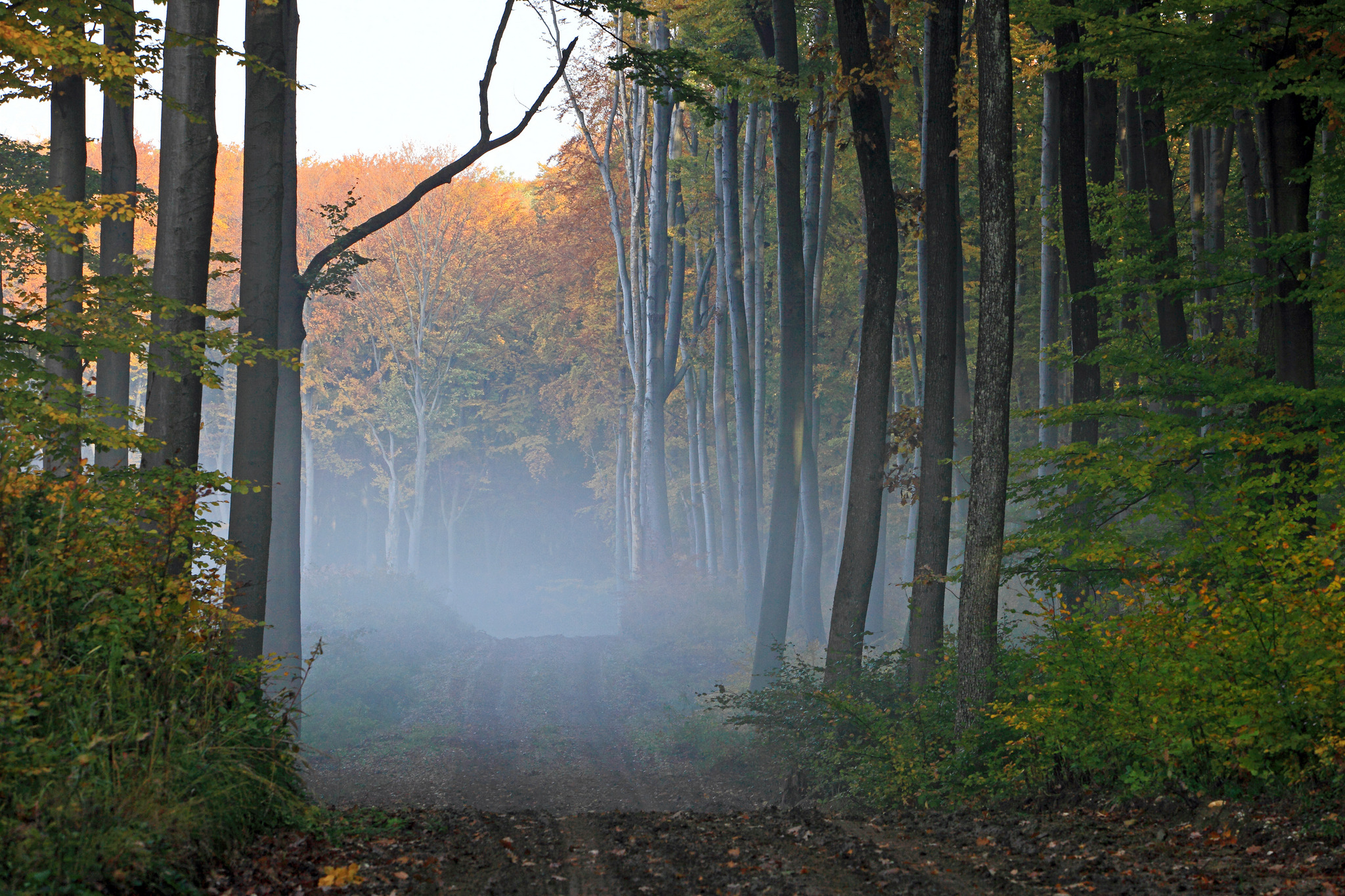
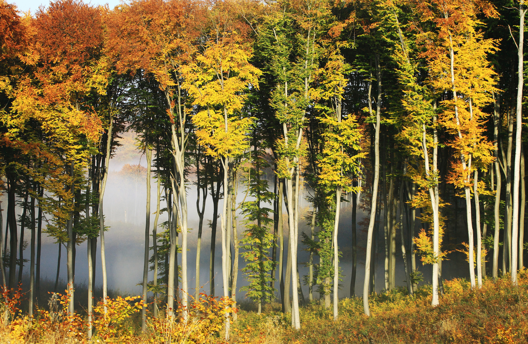
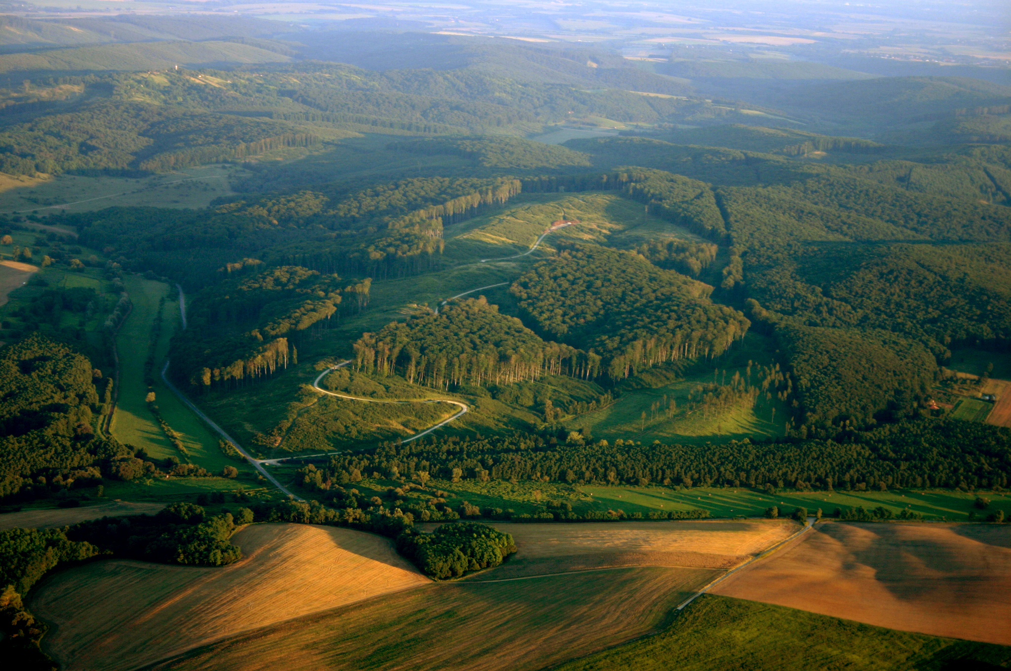
The Zalaerdő PLtd manages on the western part of Hungary, mainly on the administrative areas of Zala County, in forests in state ownership.
The area of managed forests takes 56 thousand hectares currently and they are located in six forestry landscapes: Őrség, Göcsej, East-Zala-Downs, Kemenes-Ridge, Marcal-Basin and inner-Somogy. The following areas of the regions of these forestry landscapes belong to the management of Zalaerdő PLtd: Low-Őrség, Göcsej-downs, Kerka-Mura-Plain, East-Zala-loess-land, Kanizsa-Sand-land, Low-Kemenes-Ridge, Kemenes-Bottom, and Inner-Somogy-sand-Land.

| Low-Őrség | Göcseji-Downs | ||
| Kerka-Mura-Plain | East-Zala-Loess-Land | ||
| Kanizsai-Sand-Land | Low-Kemenes-Ridge | ||
| Kemenes-Bottom | Inner-Somogy-Sand-Land | ||
| Forests managed by Zalaerdő PLtd |
Őrség
Őrség is situated in the region in the south from the River Rába, the westernmost forests managed by Zalaerdő PLtd are located in Low-Őrség. Low-Őrség is the excellent gravel cover of the River Rába which is covered mostly by clay loam of the ice age. The waterproof quality of the surface is boosted the gravel layer under the loam of the ice age. The region is divided by the valleys of the streams flowing into the River Rába in the north and the valleys flowing into the River Zala and River Kerka in the south.
The climate is under cool moderate and humid effects, it is of sub-alpine climate, with the highest level of precipitation in the country. The average annual mean temperature is 9.5 °C; the average annual amount of precipitation is 738 mm. According to the average details of the area climate of beech-woods characterises the landscape. Falling precipitation of rain shower can cause airless conditions and generate stagnant water in the soil, therefore, scotss pines and oaks live there first and foremost as they prefer these circumstances. Beech-woods can be seen on the soils with better water permeability.
Brown forest soil with stagnant water could evolve on the loam soils mostly. Beech- and hornbeam-oak-woods are determining on the landscape with a lot of forested areas, they vary with forests shunning chalk mosaic-like. Scots pines have significant populations, Salici cinereae and alder groves are typical on the areas with the effects of excessive water.
Göcsej
The Göcsej forestry landscape is the most determining in our silviculture activity, which can cover the former Göcsej beech region more or less and the Göcsej pine region partly. It consists of two regions: Göcsej-Downs and Kerka-Mura-Plain.
Göcsej-Downs are divided really meticulously. Soils developed on the loess depositions on top of the hills and on the loams of the ice age. Native loam can raise the surface on a lot of areas on the steel and eroded slopes. The terrain is characterised by hill ranges divided by ravines in north-south direction and by the narrow valleys between the hill ranges. High-plain-like ridge can be seen just on small areas; the height above sea level varies between 140-330 m. The main feature of Kerka-Mura-Plain is the large quantity of water which is due to, on the one hand, the amount of precipitation and on the other hand, the watertight clayed surface layers and the slight gradient.
The climate of Göcsej is influenced by both sub-alpine and sub-Mediterranean effects. The annual amount of precipitation is above 800 mm, more than the half of this falls in the breeding period. Precipitation maximum is typical in June and in September. The humidity of the air is high and the climate is balanced and cool because of the frequent summer rain showers.
Soils with great fertility developed on the loam basic rock of loess of the native deposition. Brown loam forest soil is typical and the CaCO3-free fertile soil layer exceeds 1 m. Soil sub-types with stagnant water can be found on the hillsides with gentle slopes, at the foothills and in the valleys; whereas brown forest soils with stagnant water are in the valleys with higher water supply. Meadow forest soils can be found on the valley areas with leaking water, whereas alluvial soils are along the watercourses of the landscape (Kerka, Mura, Válicka, Cserta). Excellent forest populations grow on each type of soil.
The specific forest association of the landscape is beech-woods, in which sessile oaks can be found on the top of the hills, common oaks and scots pines are at the foothills, and these are accompanied by hornbeams everywhere. Typical accompanying tree species are sweet cherries on the hillsides, sycamore maples, Scotch elms and common ashes in the valleys and in the gorges. On the northern part of the landscape scots pines appear as native species, forming valuable, more stories populations. Common oaks and black alders often appear along the watercourses.
East-Zala-Downs
Significant forest areas managed by Zalaerdő PLtd are located on the eastern part of Zala County, in two regions of the forestry landscape of the East-Zala-Downs. The determining region of the landscape is the East-Zala-Loess-Land, which consists of hill ranges of north-south direction and valleys of variable width. Steams generally flow on the bottom of the valleys, their flowing is not provided at some places, therefore, stagnant water areas can develop. The physiognomy of the region developed in the Pleistocene; 2-3 m thick loess cover is deposited on the surface. Divisions typical for loess-lands, steel hill tops and valleys with ravines characterise this area, the height above sea level varies between 150-280 m. Forests are located first and foremost on the top of the hills, wide, filled-up marsh valleys are mostly treeless (valleys of the River Zala and the Principális-Canal). The Kanizsa-Sand-Land region is a former river bed and its basic rock is chalk sand. Its surface is gently wavy, with dunes in north-south direction.
Both sub-Atlantic and sub-Mediterranean effects are characteristic for the climate of the East-Zala-Loess-Land, although the Mediterranean effect is more dominant. The annual amount of precipitation is below 750 mm, the average annual mean temperature is 105 °C. In the northern part of the region continental effects increase. The tops of the hills are drier; wind and sunshine can affect them more. More intensive summer warming and greater frequency of late frost are typical for the climate of the Kanizsa-Sand-Land. Extreme dry conditions can develop on the dunes because precipitation flows off rapidly.
The East-Zala-Loess-Land has soil types developed mostly on loess with a great fertility potential. The most widespread soil type is the carbonate-free, brown loamy forest soil. Ramann-type brown forest soils can be found on the loess hills of the northern landscape. The fertility layer of the soil is 60-80 cm there; it is chalk-free but rather dry. The typical soil type of the Kanizsa-Sand-Land is rust brown forest soil, with more than 80 cm fertility layer. Rust brown loamy forest soil is better for forests; clayey spots appear in its structure. Illuviation brown forest soils and gently humus carbonated sand-soils can be found in the region. The proportion of meadow soils and alluvial forest soils is significant in valleys and along watercourses in the entire landscape; most of them have permanent i.e. temporary water effects.
The forest associations of the East-Zala-Loess-Land vary as for their exposure, the type of soil and water supply. In the northern and eastern exposures there are beech-woods, on the top of the hills Turkey oak- and sessile oak-woods, on the hillsides sessile oak-woods, and at the foothills common oak-woods are the characteristic forest types. Common oaks are accompanied by common ashes and black alders in the valleys, whereas alder-woods can be found on the marsh soils. Because of some culture effects acacias and scots pines can be found on a lot of areas. Typical mixed tree species are hornbeams, sweet cherries, sweet chestnuts, small-leaved lindens and maples. The most widespread forest type of the Kanizsa-Sand-Land is hornbeam-common oak-woods, Turkey oaks and scots pines in the upper level, hornbeams or small-leaved lindens in the level of shrubs. In drier weather conditions common oaks are accompanied by birches, whereas in more humid growing regions by common ashes and fluttering elms. Alder-woods are situated in the dips and the flats between sand dunes. Acacia-, scots pine- and black pine-woods can be found on the driest growing regions.
Kemeneshát
Zalaerdő PLtd manages the southern region of the Kemenes-Ridges, on the southern part of Low-Kemenes-ridge. The basic rock is quartz gravel cover swept down by the amount of water pouring down from the Alps, with a bit of loess layer. The Low-Kemenes-Ridge consists of gentle hill tops and it is also flat, the height above sea level varies between 150–250 m.
Moderate cool and moderate humid climate effects characterise the region, the average annual mean temperature is 9.9 °C, and the average annual amount of precipitation is 675 mm.
The soils have a great variety. According to the basic rocks gravel structure soils, rust-brown forest soils and other brown forest soils can be found on the growing regions mostly independent from water excess,.
Beech- and alder-woods are located besides the tree populations of common oaks, sessile oaks and Turkey oaks as main tree species on the better growing regions of the Low-Kemenes-Ridge. Mixed tree species are: sweet cherries, birches, field maples, field elms, white-willows and scots pines. Acacias can be found in the divided trenches with ravines everywhere, extended tree populations are on the shallow, cemented gravel areas.
Marcal-Basin
Forest areas managed by the Zalaerdő PLtd are situated in the western region of the Marcal-Basin, on the southern part of the Kemenes-Bottom, in the north-eastern corner of Zala County. Kemenes-bottom is a terrace slope gently divided by steam valleys; sand and clay are soil forming rocks, on which rust-brown forest soils and humus sand-soils can be found first of all.
The landscape is affected by moderate warm and moderate humid effects. The average annual mean temperature is 10.4 °C, the annual amount of precipitation is 636 mm. Turkey oak- and hornbeam-oak-woods form the natural vegetation on the higher terraces of Kemenes-Bottom; however, acacia- and scots pine-woods can be found there as well.
Inner-Somogy
Forests managed by the Zalaerdő PLtd are situated on the westernmost part of the region of the Inner-Somogy-Sand-Land of the forestry landscape of Inner-Somogy. The region was formed by the rivers arriving from the north before and later by the wind. The climate is moderate warm and moderate humid. The average annual mean temperature is 10.3 °C; the average annual amount of precipitation is 732 mm.
Sand-soils can be found on the Inner-Somogy-Sand-Land. Hornbeam-common-oak-woods determine the natural vegetation. Hardwoods, Salici cinereae and alder-woods developed in the wide valleys between the ridges.


